 RPG Reference
Home . What's New
|
|
|
 |
 |
|
|
Middle Earth Role Playing Hub MERP Cities - Fortresses - Citadels | MERP Sourcebooks | MERP Adventures | MERP Gamebooks | Rolemaster Foreign Language Roleplaying Games has several editions of MERP in other languages MERP 2nd Edition Campaign Books BROWSE MY MERP ITEMS CURRENTLY IN STOCK  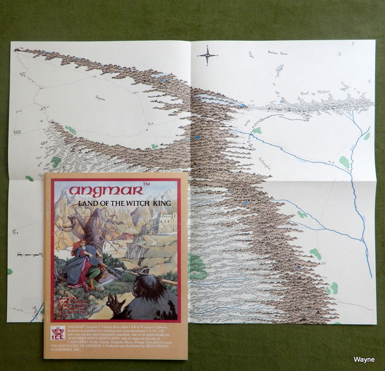 Angmar, Land of the Witch King "Angmar contains: * 4 major floor plans * 8 B & W maps * Cultures, herblore & guidelines for running your own adventures * A 16" x 20" full-color double-sided detachable mapsheet, side #1 of which details the NORTHERN MISTY MOUNTAINS, side #2, maps out the city of CARN DÛM * Trolls, Giants, Dragons, Bears, Wargs, Orcs and of course THE WITCH KING OF ANGMAR BACKGROUND It is ever so with the things that men begin: there is a frost in Spring or a blight in Summer, and they fail of their promise" (LotR III, p.182). Elendil and his heirs arranged two kingdoms when they came to Middle-earth from Numenor; Gondor in the South, and Arnor in the North. Both were fair and prosperous kingdoms at the beginning of the Third Age. At this time the history of the two kingdoms parted; the star of Gondor rose, but that of Arnor fell into darkness. Two forces brought the destruction of the North Kingdom. The first was the waning of the Dunedain who dwelt in Arnor. The second, and far greater was the shadow that came from the land of Angmar. The men of Arnor withstood the evil power of the Witch King for six long centuries, a tribute to the strength and power of the Dunedain of the North. Arnor had suffered comparatively little in the war against Sauron at the conclusion of the Second Age, and the kingdom should have prospered. Although the numbers of the Dunedain had been reduced, they were still great. The climate of Arnor was mild and the land was fertile and free of enemies. For a few hundred years matters went well, but the air of Eriador seemed unwholesome for the descendants of Numenor. Arnor fell into decline long before the land held any whisper of the shadow of Angmar. For reasons unknown the Dunedain abandoned their capital of Annuminas upon the shores of Lake Nennuial, and withdrew to the lesser fortress city of Fornost. The kingdom of Arnor was doomed to "a frost in Spring, and a blight in Summer." The heirs of the kingdom could no longer agree on the succession to the throne of Arnor in the ninth century of the Third Age. In T.A. 861 the strength of the northern realm was divided into three kingdoms: Cardolan, Rhudaur, and Arthedain. The quarreling continued; Rhudaur and Cardolan contested the possession of the tower of Amon Sul and its Palantir. The watch on evil slept in the north; men turned inwards and concerned themselves with their own affairs. The rumours of evil multiplying in the mountains did not interest them; for Arthedain and Cardolan at least, the mountains were a long way off. None gave their attention to the unpromising valley in a northern fork of the Misty Mountains. The Witch King arose in Angmar during the realm of Malvegil of Arthedain, some time between T.A. 1272-1349. Men became aware of the growing evil in the mountains, but Angmar was still preparing its power. No assaults on the Dunedain came until Argeleb, the son of Malvegil, assumed the throne. The next sixty years were dark ones for the Dunedain of the North. The Dunedain of Rhudaur were driven out by evil hillmen in league with Angmar and Argeleb was slain in battle. Together Arthedain and Cardolan held the Weather Hills against Angmar. In 1409 T.A. the Witch King of Angmar released his deadliest assault. Amon Sul was raised and burned and the Dunedain were forced to flee westward. Cardolan was laid to waste. Help came to the Dunedain from the Elves of the Grey Havens, Rivendell, and Lorien. The armies of Angmar were repelled from Fornost and the North Downs, and forced to withdraw to Angmar. The shadow of the North was contained for a time. ANGMAR The land of Angmar is one of the grimmest places in all of Middle-earth. It is not black and twisted like Mordor, but heartbreakingly cold and barren. It lies in a northern fork in the Western Misty Mountains, and in the Eastern Misty Mountains. Little activity is centered upon the barren plain between the fork in the mountains; the border guard of men is set in the rolling hills upon the edge of the low plateau. These men watch the long border road that runs from Carn Dûm to the southern tip of Angmar. The orcs prefer the safety of the tunnels in the mountains. In the East the Witch King has no border guard; the mountains bar entry into Angmar from that direction, except to those who know the orcish tunnels." 1982 ... Heike Kubasch ... 47 pages ... ICE 2300 ... ISBN 0915795078 (printed on rear cover of later printings) Check Wayne's Books Inventory  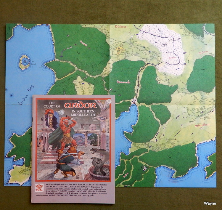 The Court of Ardor in Southern Middle Earth Maps: 1) Massive color regional, Mumakan in the SE, Tuktan in the NE, Taaliran in the SW, Tanturak in the NW. 2) Color city maps: Sarul, Korlan, Tanith, Gaven. "Experience the ancient swamp ruins & island citadels held by dark elven lords and their fierce minions. ARDOR contains: A 16" x 20" full-color double-sided detachable mapsheet 4 B & W maps 8 major floor plans INTRODUCTION Within this book is held the tale of the history of the land known as the Mûmakan and an organization of Evil known as the Court of Ardor. Also told is the story of the preparations of the Court for a cataclysm which, if it were to occur, would have dire repercussions not only for the lands of the Mûmakan, but all of Middle-earth. Long ago in the dim past of Ender Elven lords came to this southerly area, to a land swathed in warm mists and overgrown with wild yet beautiful trees and vines, and inhabited by all manner of creatures. It was vastly different from the forests and plains to the North, yet the Elves loved it and named it Ardor (S: 'Exalted Land'). Many centuries passed, and the Immortal Children of Eru lived in peace, until the Shadow fell upon the land and many of the strong were seduced by the clever words of servants of the Black Enemy: Morgoth. Power and wisdom were promised, if they would but perform this one task. Naive were these Elves in the Elder days, and they made oaths lightly, little knowing how heavily this would weigh upon them in the millennia to come. Eagerly they took council and formed a Court of sorts; a hierarchy of lords and ladies to effect this mission for their master. And a Darkness of spirit fell upon the land: a harbinger of the true dark which was to follow should their scheme come to fruition. Ages passed, and men, the younger Children, came and settled in Ardor, giving it a name in their own tongues - Mûmakan, after the huge beasts which roam the region. But Ardor still it was to the Court, and Ardor it would be again, when the eternal night fell upon all of Middle-earth." 1982, 1983 ... Terry K. Amthor ... 52 pages ... ICE 2500 Check Wayne's Books Inventory  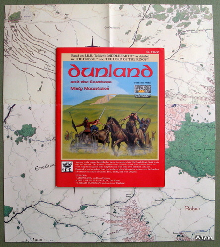 Dunland and the Southern Misty Mountains Dunland and the Southern Misty Mountains
Maps: 1a) Color regional, Enedhwaith in the west, Rohan in the east. 1b) B&W Larach Duhnnan village & Enedhwaith regional. 2a) Color regional, Bree in far NW, Eregion in SE 2b) B&W sociological map of region. "Journey to the rugged foothills that rise to the north of the Old South Road. Strife is the rule in Dunland. The warlike Dunnish clans jealously guard their independence and often stage raids against their neighbors and even their own kinsmen. And yet Dunland is less hazardous than the Southern Misty Mountains, where even the hardiest adventurers run afoul of Giants, Elves, Trolls, and even Dragons. EXPLORE: "AMON LIND, an Elven Fortress THE LAIR OF TURUKULON, The Worm LARACH DUHNNAN, trade center of Dunland Adventure in the Southern Misty Mountains north of the wide Isen Gap joining Tharbad to the markets further east. Travel among the fierce Dunlendings. Because of constant infighting , this loose organization of clans is frequently influenced by Sauron and his minions. "DUNLAND and the Southern Misty Mountains includes: 4 FULL-COLOR PAGES: a 2 face regional map of Dunland and a 2 face regional map of Eregion and central Cardolan MAJOR LAYOUTS: including Amon Lind, The Lair of Turukulon, The Caerdh Wood, and the Village of Cillien THE DUNNISH CLANS: herders, hunters, and warriors feared by their neighbors OTHER INHABITANTS: Giants, Hobbits, Giant Eagles, Servants of Sauron, Noldo Elves, Smugglers, Orcs, and a Dragon." 1987 ... Randell E. Doty & Coleman Charlton (editor) & Walter Velez (cover) & Jim Holloway (interior art) ... 63 pages ... ICE 3600 ... ISBN 0915795914 Check Wayne's Books Inventory  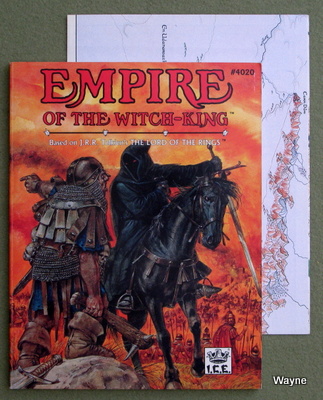 Empire of the Witch-King Empire of the Witch-King
Sneak across Angmar's borders and discover a cold, bleak land where rainfall seeps down eroded cracks and gullies to grottos and twisting caverns below. Orcs prowl this underground network, while slaves toil to wring a harvest from the scanty soil above. Circling crebain carry word of disobedience or rebellion to their master enthroned in Carn Dum, The Witch-king of Angmar. Dark-robed Warrior Priests roam the realm cradled between the Misty Mountains. They seek acolytes among the townsfolk, strike fear into the hearts of the peasantry, and enforce the Nazgul will among the soldiers. Brooding fortresses house the armies of Men that issue forth to threaten the Din of the North. Dragons, Trolls, ad Fell-beasts lurk in the sinister shadows and chasms of the towering crags. Prepare for a deadly excursion into Angmar's Witch-realm. Face indescribable dangers as you attempt to strike a blow for the Free Peoples of the North. Empire of the Witch-king features: * Descriptions of the Witch-king, his generals, and the Dragons Scorba and Corlagon. * 8 Pages of Color Maps: a 4 page map of the northern Misty Mountains and a 4 page blow-up of Carn Dum, The Witch-king's captial. * 5 Plates detailing the uniforms and equipment of the Witch-king's army: Commanders, Men of Angmar, Orc-tribes, War-wolves, and Trolls. * 128 Exciting Pages incorporating 3 major castle layouts complete with views. 1989 ... Graham Staplehurst & Heike Kubasch ... 128 pages + large doubled-sided color fold-out map ... ICE 4020 ... ISBN 1558060243 Check Wayne's Books Inventory  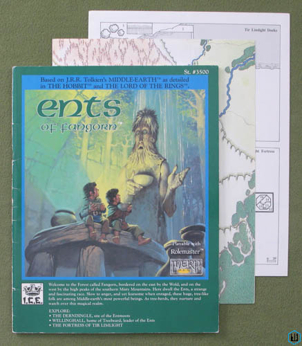 Ents of Fangorn Ents of Fangorn
Maps: 1a) Color regional, Dunfearan in the NW, Taur Fangorn in the center, Rohan in the S. 1b) B&W Limlight. 2a) Color regionals, 1st focuses on Nan Anduin, with Lorien forest in S; other the Wold, with Emyn Muil in the SE 2b) B&W sociological maps of region. "Welcome to forest called Fangorn, bordered on the east by the Wold, and on the west by the high peaks of the southern Misty Mountains. Here dwell the Ents, a strange and fascinating race. Slow to anger, and yet fearsome when enraged, these huge tree-like folk are among Middle-earth's most powerful beings. As tree-herds, they nurture and watch over this magical realm. EXPLORE: THE DERNDINGLE, site of the Entmoots WELLINGHALL, home of Treebeard, leader of the Ents THE FORTRESS OF TIR LIMLIGHT "Fangorn is a sheltered land containing an isolated society rooted in an ancient atmosphere. Its eerie environment is well suited to the myriad trees that reside here under the watchful eyes of their Ent guardians. Like the Old Forest of Eriador, Fangorn is a remnant of the forest which once covered Middle-earth. ENTS OF FANGORN includes: 4 FULL-COLOR PAGES: a 2 page spread of Fangorn, the southern Misty Mountains, and Dunland, plus a 1 page view of the area to the east (including the Wold and Dol Guldur region) and a map of Lorien, which lies to the north MAJOR LAYOUTS: detailed maps of Wellinghall, the Falls of Mist, the Town and Fortress of Tir Limlight, and the Caverns of Pain THE ENTS OF FANGORN: powerful tree-herds THE BARZ THRUGRIM: a treacherous band that threatens travels through the Wold INTRODUCTION "This work focuses upon the huge woodland that lies along the southeastern flank of the Misty Mountains (S. "Hithaeglir"). This sy]van realm is commonly called Fangorn (S. "Beard of the Tree") after the great Ent that Men know as "Treebeard." Fives speak of the forest as Tauremorna (Q. "Black Forest"), while the Men of Rohan call it simply "Entwood." Ambarona (Q. "Land of Doom") is the shortened Entish name." 1987 ... Randell E. Doty & Coleman Charlton & Peter C. Fenlon & Angus McBride ... 48 pages ... ICE 3500 ... ISBN 0915795841 Check Wayne's Books Inventory  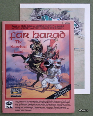 Far Harad, the Scorched Land Far Harad, the Scorched Land
Far to the south of the warring realms of Gondor and Mordor, lies an area of harsh winds and blazing sun known to its inhabitants Bozisha-Miraz. It encompasses the lower half of the great desert of Haradwaith, and area labeled Far Harad on the maps of the northern world. Its watering holes and seaports teem with trade and intrigue - its wilds hold ancient mysteries and untold dangers. Though the region is little more than arid highlands, tortured canyons, and a half-score of oases, adventure and high-living await you under the southern sun of Far Harad. Adventurers find Far Harad rich with challenge. In the port city of Dar, hired swords are always in demand. The vast desert looms ominously with its secretive population of Sandmen and natural hardship. Men tell of entire cities swallowed by the Dune Sea. Ghosts and demons are said to walk the shifting land, guarding treasures beyond imagination. All this and more await the brave in the Scorched Land. FAR HARAD The Scorched Land includes: 4 FULL-COLOR MAPS covering the region and two major cities: Dir Halon and Caras Pharaz A 4-PAGE CITY MAP of the great trade center of Bozisha-Dar. MAJOR LAYOUTS: detailed layouts of a key fortress, Gusar's Djebel; the oasis of Sud Sicanna, and other adventure sites. IN DEPTH INFORMATION on cultures, people, creatures, treasures, politics, and warcraft found in the deserts of Southern Middle-earth. BACKGROUND AND STATISTICAL INFORMATION for key figures like the 7-regent councilors of Bozisha-Dar, Haradan warriors, and the accursed desert minions of the Lord of the Rings. 1988 ... Charles Crutchfield & John David Ruemmler (editor) & Peter C. Fenlon (map) & Angus McBride (cover) & Sean Sharp (interior art) ... 56 pages ... ICE 3800 ... ISBN 1558060073 Check Wayne's Books Inventory  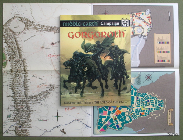 Gorgoroth "For thousands of years, the Men of the West stood guard over the Black Land, ever vigilant to prevent the return of Sauron's might. The Great Plague has broken that watch, and evil stirs east of the Mountains of Shadow. Torchlight glares from arrow slits of once-abandoned citadels, and smoke unfurls from Orodruin's long quiet summit. Foul beasts move by night through cracks in the broken surface of Gorgoroth's volcanic plateau. GORGOROTH includes: • 11" x 17" FULL-COLOR MAP depicting the plateau of Gorgoroth. • 2 FULL-COLOR CITY MAPS (on the reverse of the terrain map) showing Ostigurth, the City of Death, where new recruits to the Dark Lord's forces are indoctrinated , and Bar Lithyrn, a Gondorian mining town on the northern slopes of the Ash Mountains. • 4 CHILLING ADVENTURES on the foothills of the Ash Mountains that provide the daring with an unexpected introduction to Mordor. • DETAILED LAYOUTS of Mount Doom, Carach Angren, and other significant fortresses under the Lidless Eye. • IN-DEPTH INFORMATION on the military hierarchy of Mordor and its prominent leaders. • STATS AND BACKGROUND INFORMATION for all Nine Ringwraiths, as well as the heinous Lords of Mordor who implement the schemes devised by the Ulairi." 1990 ... Pete Fenlon & Coleman Charlton & Jessica Ney & John Crowdis & Keith Robley & Anders Blixt ... 144 pages ... ICE 3112 ... ISBN 1558061053 Check Wayne's Books Inventory  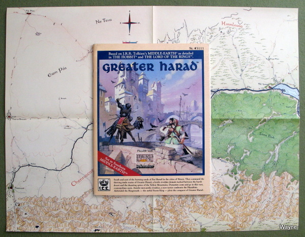 Greater Harad Maps: 1) Huge Color regional, city of Tul Poac in the NW, Chennacatt in the SW, Kirmlesra in the NE. 2) Color city maps of Tul Isra, Tul Harar, and Charnesra. "South and east of the burning sands of Far Harad lie the cities of Sirayn. They command the thriving trade routes of Greater Harad, a fertile riverine domain tucked between the harsh desert and the daunting spires of the Yellow Mountains. Dynasties come and go in this vast, cosmopolitan oasis. Amidst mercantile rivalries, a new terror confronts the Haradrim. Akhorahil the Ringwraith - the awful Storm King - plots the conquest of Greater Harad. Seek your fortune in the lands of Greater Harad where merchant-lords dominate the roads and sinister tyrant enthroned in Tul Isra rules the once independent cities. Dark minions sway the populace, and slavery thrives. Whispered tales about Obed of the Masra hint that the hero's legendary weapons lie unclaimed in a ruined catacomb. GREATER HARAD includes * 22" x 17" FULL-COLOR MAP depicting the region. * 3 FULL-COLOR CITY MAPS showing Tul Isra, Tul Harar, and Charnesra. * DETAILED LAYOUTS of the ancient mines beneath Ghabaras, the haunted caverns of Mogholy Dask, and other adventure sites. * IN-DEPTH INFORMATION on the peoples, cultures, politics, trade routes, and warcraft dominating the river valleys of Greater Harad. * STATS AND BACKGROUND INFORMATION for prominent individuals such as Tartas Izain, the Taraskon of Tul Isra, and his evil Nazgul master, Akhorahil the Storm King." 1990 ... William E. Wilson ... 80 pages ... ICE 3111 ... ISBN 1558061002 Check Wayne's Books Inventory  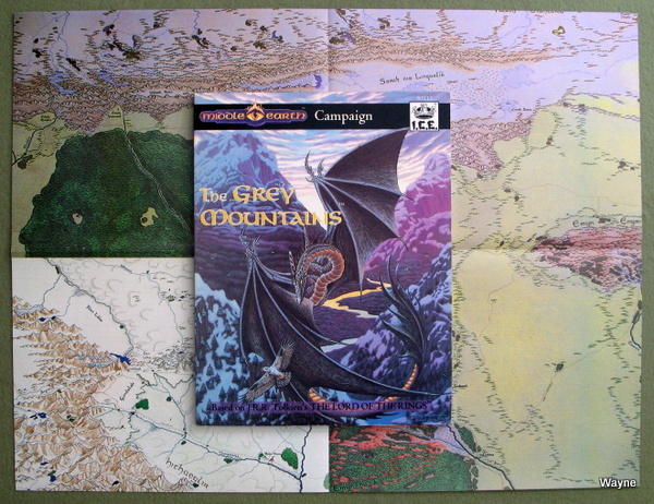 The Grey Mountains Forming the northern border of the Rhovanion and Mirkwood, the Grey Mountains span four hundred miles: from Angmar's Witch-realm to the Iron Hills. Shot through with Dwarven mines, Orc warrens and Dragon caves, the Ered Mithrin are a cold and foreboding ranges. They promise treasure and adventure, but more often deliver an untimely demise to explorers. Take your Middle-earth campaign to the edge of the chill Forodwaith and send your players across the deadly Withered Heath; just beware of Dragons! The Grey Mountains includes: 17" x 22" Full-Color Map depicting the Grey Mountains range and Northern Rhovanion. 9 Challenging Adventures, including a 4-adventure mini-campaign. These travails take explorers from one end of the Grey Mountains to the other. Detailed Layouts of the Dwarven city, Norr Dum, the Ice-orc fortress, Kala Dulakurth, and numerous other haunts scattered throughout this imposing mountain range. In-depth Information on the Dragons and Dwarves of the Grey Mountains and the Withered Heath. Stats and Background Information on numerous personalities and beasts who wander the frigid north of Middle-earth. 1992 ... Craig Paget & Karen McCullough & Joseph A. McCullough V ... 142 pages ... ICE 3113 ... ISBN 1558061541 Check Wayne's Books Inventory  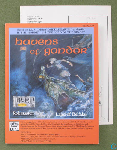 Havens of Gondor, Land of Belfalas Havens of Gondor, Land of Belfalas
Maps: 1a) Color regional, Lamedon in the north, Belfalas & Tolfalas in the south. 1b) Color smaller version of regional map; B&W maps of Edhellond. 2a) Color city map of Dol Amroth. 2b) B&W side-section of tower & town map of Linhir. Sail the rugged seas off Gondor's south coast, where Corsairs of Umbar battle the majestic white ships of Dol Amroth. Here, the Elves built the great haven of Edhellond and Galadriel erected the Sea-ward Tower, most famous beacon of all Middle-earth. Journey along the twisting streets of Dol Amroth, City of Princes, and bustling capitol of Belfalas. EXPLORE: DOL AMROTH, one of Gondor's finest ports, EDHELLOND, the Elfhaven, home of tunnel-harbours and magic Swan-ships, LINHIR, the gateway to central Gondor, BELFALAS, the province of the Princes. Set against the backdrop of wild coastal highlands, cliff-lined bays, and eerie islets, HAVENS OF GONDOR offers unparalleled excitement! Unravel the intrigue of the court of Dol Amroth, discover the mysteries of of the Elfhaven, battle smugglers and Corsairs, feel the power of the dark religion over the remote mountain villages. HAVENS OF GONDOR includes: 5 FULL-COLOR PAGES: a beautiful 2 page area map of the Belfalas region of Southern Gondor; a full-page regional map; and a 2-page map of Dol Amroth, City of the White Ships. MAJOR LAYOUTS: include 2 maps of the Elf-havens, the port of Linhir, a dangerous mountain village, a sea-ward tower, the Hill of the Pyre, Castle Amrûnaur, plus 2 pages of ship deck plans. THE PRICES OF DOL AMROTH: knights whose Elf-tinged blood and unwavering loyalty make them Gondor's greatest vassals. THE CORSAIRS OF UMBAR: pirates whose sleek warships threaten the mightiest of Gondor's castles. 1987 ... Carl Willner ... 56 pages ... ICE 3300 ... ISBN 0915795256 Check Wayne's Books Inventory  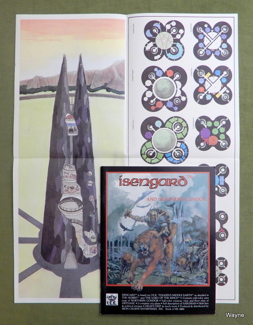 Isengard & Northern Gondor Isengard & Northern Gondor
I have MERP books mapped onto Gondor & Rohan over at my photoblog: GONDOR & ROHAN (MERP RPG books Mapped by Region, Part 3) "Contains full-color area map of NORTHERN GONDOR, full-color cutaway view and floor plan of ORTHANC, 2 complete city plans, full description of SARUMAN, herb lists and political intrigue, HELM'S DEEP & much more. The citadel of Isengard was built by the Númenórians in a sheltered valley at the southern limits of the Misty Mountains. Its main purpose was to defend the gap of Calenardhon and the Fords of Isen against attacks by Sauron's forces. Self-sufficient and enchanted, it later became the virtually impregnable fortress of Saruman the White. No spire in Middle-earth was stronger, save the Dark Tower of Mordor. ISENGARD AND NORTHERN GONDOR includes: • 8 FULL-COLOR PAGES: a 2-page regional map, maps of Calmirië (Aldburg) and Dunlostir , plus 4 pages on the Tower of Orthanc • MAJOR LAYOUTS: The Underground Levels of Orthanc, The Entry Passage, and The Hornburg • THE FORTRESS OF ISENGARD: one of the greatest architectural creations in all of Middle-earth • OTHER INHABITANTS OF THE REGION: The Calenardhrons, The Dunlendings, and the Drúedain" 1983, 1987 ... 48 pages ... ICE 2800 ... ISBN 0915795116 Check Wayne's Books Inventory  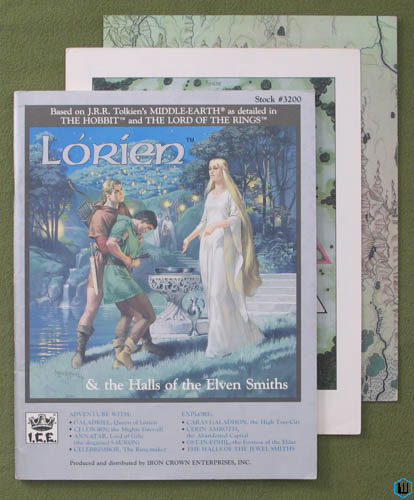 Lorien and the Halls of the Elven Smiths Lorien and the Halls of the Elven Smiths
Maps: 1a) 2-panel color city map of Ost-in-Edhil 1b) Regional map of Lorien 2a) Caras Galadhon, Cerin Amroth on left panel; area map of Eregion 2b) House of the Mirdain; map of Middle-Earth "GALADRIEL, Queen of Lórien CELEBORN, the Mighty Grey-elf ANNATAR, Lord of Gifts (the disguised Sauron) CELEBRIMBOR, The Ring-maker EXPLORE: CARAS GALADHON, the High Tree-City CERIN AMROTH, the Abandoned Captial OST-IN-EDHIL, the Fortress of the Eldar THE HALLS OF THE JEWEL SMITHS The reasons why one Elven kingdom survived to see the dawn of the Fourth Age and why one fell to the Dark Lord over four thousand years earlier are myriad... All the while Lórien, though nearer to the Black Land, lay shrouded and quiet, its mistress too strong to be overcome by the devices of the wraith-prince in Dol Guldur, and too clever to become a target for the Dark Lord himself. LÓRIEN contains: 8 FULL COLOR PAGES: Campaign across the perilous Misty Mountains on 4 Regional Maps or delve into intrigue in 3 great cities. 12 MAJOR LAYOUTS: Explore Citadels, Manors, Ruins, and of course the Halls of the Jewel Smiths, each an ideal adventure site laden with traps and treasure. ELVEN HISTORY AND BACKGROUND: Learn about the lore and nature of Elves, with the extensive material on the noble Noldor, proud Sindar, and mystical Silvan lines. THE THREE RINGS OF POWER: Read about three of Middle-earth's greatest magic items, the story of the making of the Rings, and a complete description of NENYA, the Water-ring." 1986 ... Terry Kevin Amthor ... 62 pages ... ICE 3200 ... ISBN 0915795426 Check Wayne's Books Inventory  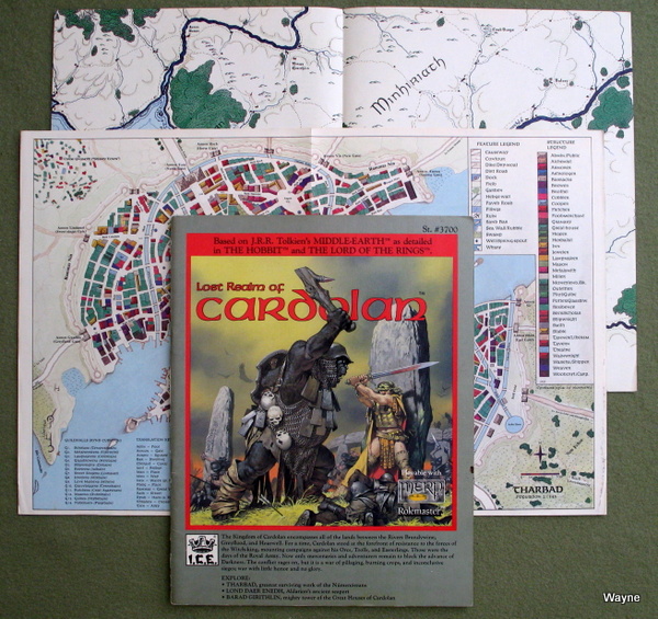 The Lost Realm of Cardolan The Lost Realm of Cardolan
Maps: 1a) Color regional map of Cardolan between the two rivers, Shire in NW, Tharbad in far south. 1b) Two-panel color city map of Tharbad. 2a) Color regional map of southern coast. Minhiriath in center, Eryn Vorn forest in the west. 2b) B&W town map of Suduri & regional sociological maps. "The Kingdom of Cardolan encompasses all of the lands between the Rivers Brandywine, Greyflood, and Hoarwell. For a time, Cardolan stood at the forefront of resistance to the forces of the Witch-king, mounting campaigns against his Orcs, Trolls, and Easterlings. Those were the days of the Royal Army. Now only mercenaries and adventurers remain to block the advance of Darkness. The conflict rages on, but it is a war of pillaging, burning crops, and inconclusive sieges; war with little honor and no glory. EXPLORE: THARBAD, greatest surviving work of the Númenórians LOND DAER ENEDH, Aldarion's ancient seaport BARAD GIRITHLIN, mighty tower of the Great Houses of Cardolan Life is hard and unforgiving for the peoples of Cardolan. For those with ambition and a strong arm it is a time of opportunity. The Princes of Cardolan are always at war, and few mercenary bands ask for references. Sell-swords, noted for low pay and a high mortality rate, fuel the constant strife. For those with a higher purpose in mind, there is always the threat of the Witch-king and his agents. The mightiest of the these is the noxious Warlord whose demise few would lament. LOST REALM OF CARDOLAN includes: 6 FULL-COLOR PAGES: 4 pages of Cardolan regional maps plus a 2 face city map of Tharbad MAJOR LAYOUTS: complete maps of Lond Daer Enedh during different periods, as well as the towns of Sudúri and Metraith, the fortresses of Argond and Barad Girithlin, and the Palace of Thalion THE INHABITANTS: the Dúnedain, Eriadorans, the Clansmen of Saralann, the Beffraen, and the Northmen and Hobbits" 1987 ... Jeff McKeage ... 48 pages ... ICE 3700 ... ISBN 0915795957 Check Wayne's Books Inventory  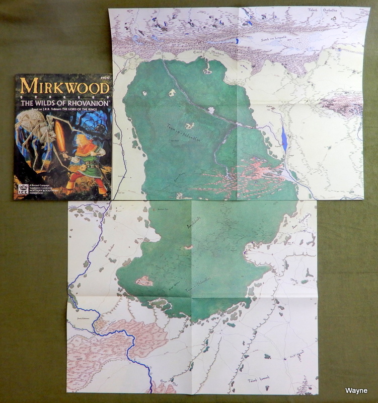 Mirkwood: The Wilds of Rhovanion Mirkwood: The Wilds of Rhovanion
Maps (Two huge 4-panel fold-outs): 1a) Color regional, Nan Anduin in NW, Wold in SW, Talath Harroch in SE, Aur Esgalabor in NE. 1b) Color detail maps, Dol Guldur, Buhr Ailgra, Woodmen-town. 2a) Color regional, Taur-e-Ndaedlos in center SW, Talath Oiohelka in NE. 2b) B&W detail maps, Esgaroth, Celebannon, Dale & regional sociological maps. Many more photos of this book at our games blog -Wayne "Follow the Old Forest Road into the heart of Mirkwood and you'll find yourself in deep, dark woods once full of fish and game. How strangely quiet the woods are since Mordor cast its deathly pall across the land. Only the Giant Spiders seem content as they lie in their shadowy lairs. Bordered by the mighty Anduin River to the west and the Grey Mountains to the north, the wilderland includes rugged highlands like the Iron Hills and the ancient Mountains of Mirkwood, as well as famous waterways like the River Running and Long Lake. The Rhovanion plains east of the forest provide fertile farmland and pastures, but are threatened by tribes of Easterlings. Southern Mirkwood is already under the shadow. There, Dol Guldur, the Necromancer's mist enshrouded fortress, stands as the Dark Lord's outpost - from it emanates the stench of evil and blackness of death. Mirkwood is a wilderland as yet untamed by a dominant race or civilization. Here you'll find Thranduil's Wood-elves, rustic Wood men, the Dwarves of the Iron Hills, and the primitive Beornings, as well as many other sub-cultures of Northmen. Hardly hospitable, Mirkwood is a land where careless travellers often fall prey to Wargs, Trolls, Lesser Giants, and Giant Spiders. Adding to its ills, Smaug the Destroyer and his winged cousins have for centuries made their homes in the frozen wastes just to the north. These denizens warily await your arrival, so welcome to Mirkwood, Adventurer! May your sword be quick and your senses keen! MIRKWOOD features: 2 giant 16" x 21" full-color maps detailing all of the Mirkwood region Full-color maps of Dol Guldur, Woodmen-town, and Buhr Ailgra Major B&W layouts of Dale, Esgaroth on Long Lake, Dol Guldur, Lair of the Seer, the Halls of the Elven-king, and Erebor, the Lonely Mountain Complete descriptions of the many races inhabiting the region Descriptions of Radagast, Sauron, and other famous figures" 1988 ... 128 pages ... ICE 4010 ... ISBN 1558060189 Check Wayne's Books Inventory   Mount Gundabad Mount Gundabad
"Prowl the dark, twisting, and horror-filled passages of Mount Gundabad. A site of great strategic significance to both the Witch-king and his master, Sauron, this underground Orc city guards the pass through the northern Misty Mountains. From Gundabad's imposing Drake Gate, the Warlords and their goblin hordes march to battle against the Free Peoples. Explore the grim Halls of the goblin city where Orc-lords struggle for power. Crawling with soldiers, captured slaves, and monsters from the mysterious Underdeeps, Mount Gundabad's cavern is steeped in danger and adventure. MOUNT GUNDABAD includes: 11" x 17" FULL-COLOR MAP depicting the region. A CROSS SECTION of the fortress city. DETAILED LAYOUTS of the Spires of Gundabad and the Drake Gate and comprehensive maps route maps of the Pits, the Mines, and the Fungi Caves. DETAILED INFORMATION on the Orcs, Men, chambers, passages, treasures, politics, and warcraft found in the underground fortress. STATS AND BACKGROUND INFORMATION for key figures like the Lord of the North, the Goblin-king that rules all the Orc tribes in the Grey and Misty Mountains." 1989 ... Carl Willner ... 71 pages ... ICE 3110 ... ISBN 1558060693 Check Wayne's Books Inventory  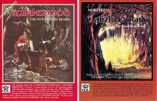 Northern Mirkwood: The Wood Elves Realm Northern Mirkwood: The Wood Elves Realm
The Wood-Elves Realm This package details all of the NORTHERN WILDERLAND and includes * 6 major layouts * a 16" x 20" full-color double-sided detachable mapsheet, side #1 of which depicts settings from THE HOBBIT, side #2 maps out LAKE TOWN, DALE, and a Wood-elf village * Journey if you dare through the shadowy depths of Mirkwood, encounter Great Eagles, Giant Spiders, Bears, Wolves, and the Dragons of the Withered Heath. 1983, 1984 ... John David Ruemmler ... 52 pages ... ICE 2600 ... ISBN 0915795086 Check Wayne's Books Inventory  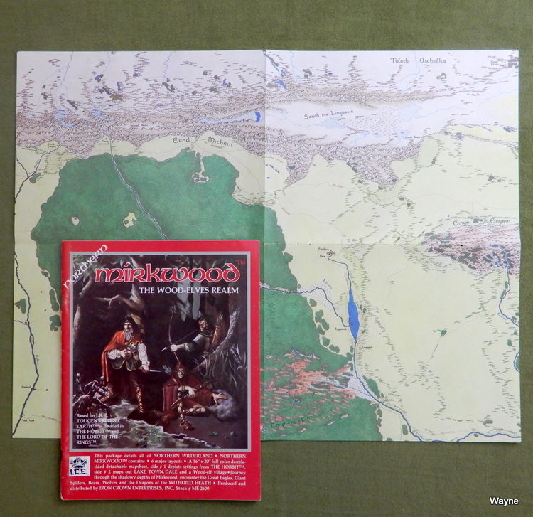  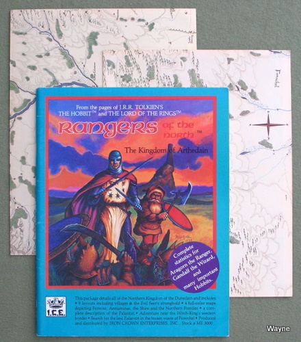 Rangers of the North, The Kingdom of Arthedain Rangers of the North, The Kingdom of Arthedain
Maps: 1a) Color regional of Arthedain, Forochel in the NW, Rammas Formen in upper middle. 1b) Color detail maps: Fornost Erain, Annuminas. 2a) Color regional centered on the Lhun river, Ered Luin in the NW, Talath Muil in the NE, Numeriador in the west. 2b) Color detail maps, Frontier Citadel & Arthedain Star-Tower. "This package details all of the Northern Kingdom of the Dunedain and includes: * 9 layouts including villages & the Evil Seer's stronghold * 4 full-color maps depicting Fornost, Annuminas, the Shire and the Northern Frontier * A complete description of the Palantiri * Complete stats for Aragorn the Ranger, Gandalf the Wizard, and many important Hobbits * Adventure near the Witch-King's western border * Search for the lost Palantiri in the frozen waste of Forochel Cradled between the mighty Misty Mountains and the Blue, Arthedain is home to the faithful of fallen Numenor, once inhabited by the highest of men. Renowned seers gather at the Royal Court in Fornost to contemplate the obscure visions of the Palantir. To the east the Witch-King of Angmar is poised like a hungry wolf, anxious to devour the last remaining Dunedain Kingdom. Against this threat stand a few whose noble heritage is obscured by the course clothing of the frontier. A secretive, wandering people are these Rangers; woodwise as Elves. Tutored by the Wizard Gandalf, and using birds and beasts as their agents, they guard and protect the eastern borders against the forces of Darkness." 1985 ... John David Ruemmler ... 56 pages + 8 panels of color maps ... ICE 3000 ... ISBN 0915795221 Check Wayne's Books Inventory  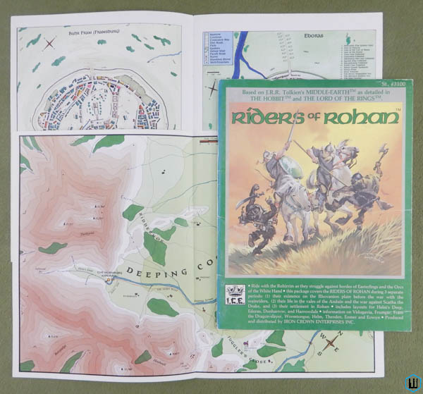 Riders of Rohan Riders of Rohan
I have MERP books mapped onto Gondor & Rohan over at my photoblog: GONDOR & ROHAN (MERP RPG books Mapped by Region, Part 3) The 2nd edition (1987) has a UPC barcode on the back cover. The B&W regional maps were moved from the reverse-side of the color maps in the center to inside the covers. A new color regional map of Rohan was added, making the 2nd edition a better value: 8 pages of maps, instead of the 6 pages mentioned on the back cover. -Wayne "Ride with the Rohirrim as they struggle against the hordes of Easterlings and the Orcs of the White Hand. This package covers the RIDERS OF ROHAN during 3 separate periods: Their existence on the Rhovanion plain before the war with the wainriders Their life in the vales of the Anduin and the war against Scatha the Drake, and their settlement in Rohan Includes layouts for Helm's Deep, Edoras, Dunharrow, and Harrowdale Information on Vidugavia, Frumgar, Fram the Dragon-slayer, Wormtongue, Helm, Theoden, Eomer, and Eowyn Almost everything about the Northmen changed with their acquisition of horses: Their hunting methods, their religious focus, their relations with other Men - Men who did not possess horses. Their attitude to the Dark Lord, however, remained unchanged. They despised him and his creations, and all evil Men who worshipped darkness ... and they still distrusted magic and magicians, no matter what side they claimed to be on. RIDERS OF ROHAN includes: 6 FULL-COLOR PAGES: a 2 page map of the Hornburg area, plus maps of Framsburg, the Drúadan Forest, Edoras, and a regional map of Rohan MAJOR LAYOUTS: of Buhr Marling (a fortified Horse-lord village), Ilanin (a wain village), The Hornburg, The Juggler's Hall, The Signal-tower, and The Inn of Greys THE RIDERS: an overview of the Northmen Horse-lords through the Third Age into the early years of the Fourth Age OTHER INHABITANTS: The Dunlendings, Half-orcs, The Servants of the White Hand, and the Drúedain" 1985, 1987 ... 64 pages ... ICE 3100 ... ISBN 0915795299 Check Wayne's Books Inventory  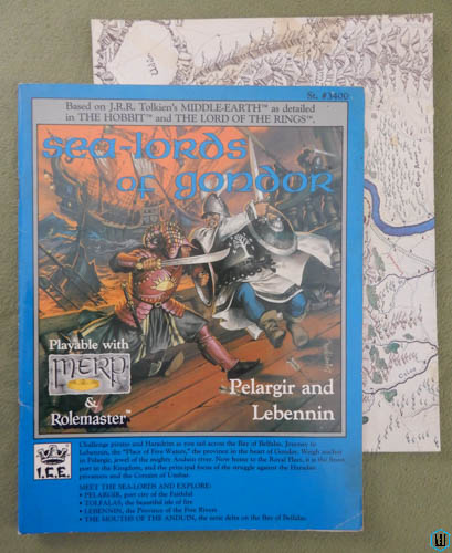 Sea-Lords (Sealords) of Gondor: Pelargir and Lebennin Sea-Lords (Sealords) of Gondor: Pelargir and Lebennin
"Challenge Pirates and Haradrim as you sail across the Bay of Belfalas. Journey to Lebennin, the "Place of Five Waters", the province in the heart of Gondor. Weigh anchor in Pelargir, jewel of the mighty Anduin river. Now home to the Royal Fleet, it is the finest port in the Kingdom, and the principal focus of the struggle against the Haradan privateers and the Corsairs of Umbar. MEET THE SEA-LORDS AND EXPLORE: PELARGIR, port city of the Faithful TOLFALAS, the beautiful isle of fire LEBENNIN, the Province of the Five Rivers THE MOUTHS OF THE ANDUIN, the eerie delta on the Bay of Belfalas. In Pelargir the Faithful of Numenor built their new homes, and in this magnificent harbor Castimir the Usurper became Lord of the Corsairs during the bloody Kin-strife. Here, Aragorn seized the Black Fleet which turned the tide at the Battle of Pelennor Fields. SEA-LORDS OF GONDOR includes: 8 FULL-COLOR PAGES: a beautiful 4 page city map of Pelargir, and 4 pages of regional maps. MAJOR LAYOUTS: the towns and citadels of Lebennin, the watch-towers of Tolfalas, and the hidden haunts of the Mountain Folk. CORSAIRS AND SEA-LORDS: the two adversaries seeking control of the vital sea-lanes of the Bay of Belfalas. SHIP PLANS: deck views, specifications, and guidelines for sea adventures." 1987 ... John Bliven Morin ... 64 pages ... ICE 3400 ... ISBN 0915795884 Check Wayne's Books Inventory  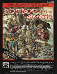 Shadow in the South Shadow in the South
Unlike the other 1st edition MERP campaign supplements, Shadow in the South's color maps are scattered throughout the text, and don't lend themselves to easy removal as with the centerfold maps in the other releases. Map 1) Ró-Molló Map 2) Ostelor Map 3) Arpel (Katerre) Map 4) Regional map, with Mirëdor in the north and Pel in the east. A more in-depth look over at our Games Gallery! -Wayne "Enter the mysterious realms of southwestern Middle-earth, a land touched by the black legacies of Morgoth and Sauron, the graceful creations of the Avar Elves, and the fiery passion of the Men of Westernesse. Here, between the Great Sea and the golden spires of the Yellow Mountains, the powerful seafaring Númenórians and their relentless successors warred with the savage Haradrim. Amidst this unceasing struggle, the wild Sedari and Drel people labor to survive and maintain their peculiar cultures. These tribes cannot run from the Shadow in the South, for they reside beyond Far Harad - at the very edge of Middle-earth. Long-settled yet full of wild shores, dark wood, and rugged mountains, south-western Middle-earth is often referred to as the Dominions of the Seven. It is a place of riches and wonder, of fiercely independent oligarchies challenged by the might of the Storm King and the terror engendered by the Lord of the Rings. SHADOW IN THE SOUTH includes: 4 FULL-COLOR PAGES covering the region and its three major cities: Ostelor, Arpel, and Ró-molló MAJOR LAYOUTS: painstakingly detailed maps and perspectives of key towns and adventure sites DETAILED INFORMATION on people, places, creatures, treasures, politics, and warcraft found in southwestern Middle-earth STATS AND BACKGROUND INFORMATION for key figures like the Storm King, the foul Ringwraith who commands Sauron's hated Army of the Southern Dragon" 1988 ... Chris Stone & Pete Fenlon ... 72 pages ... ICE 3900 ... ISBN 1558060138 Check Wayne's Books Inventory  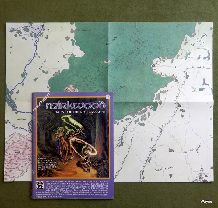 Southern Mirkwood: Haunt of the Necromancer This package details all of Southern Rhovanion. Southern MIRKWOOD contains: * 4 major layouts including DOL GULDUR * A 16" x 20" full-color insert (4 panels, doubled sided), side #1 depicts settings from THE LORD OF THE RINGS, side #2 maps out WOODMENTOWN, the HILL OF SORCERY (Dol Guldur), and a HOUSE-LORD settlement (Buhr Ailgra) * From the Undeeps to the old Forest Road, across the Battle plain called DAGORLAD, Southern Mirkwood is a land cursed by the Necromancer of DOL GULDUR. 1983 ... Susan Tyler Hitchcock ... 60 pages ... ICE 2700 ... ISBN 0915795094 Check Wayne's Books Inventory  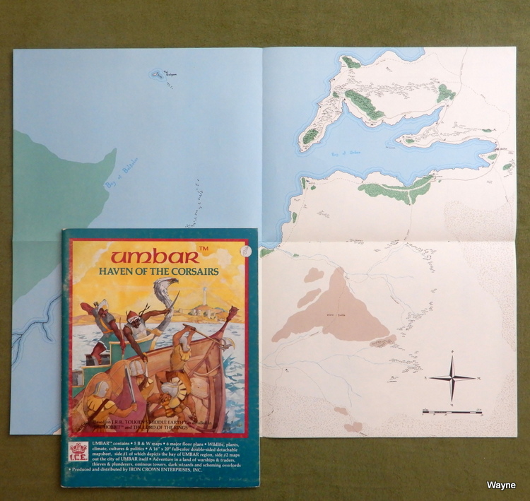 Umbar: Haven of the Corsairs "UMBAR contains • 5 B & W maps « 6 major floor plans • Wildlife, plants, climate, cultures & politics • A 16" x 20" full-color double-sided detachable mapsheet, side #1 of which depicts the bay of UMBAR region, side #2 maps out the city of UMBAR itself • Adventure in a land of warships & traders, thieves & plunderers, ominous towers, dark wizards and scheming overlords." 1982 ... Brenda Gates Spielman ... 52 pages ... ICE 2400 Check Wayne's Books Inventory  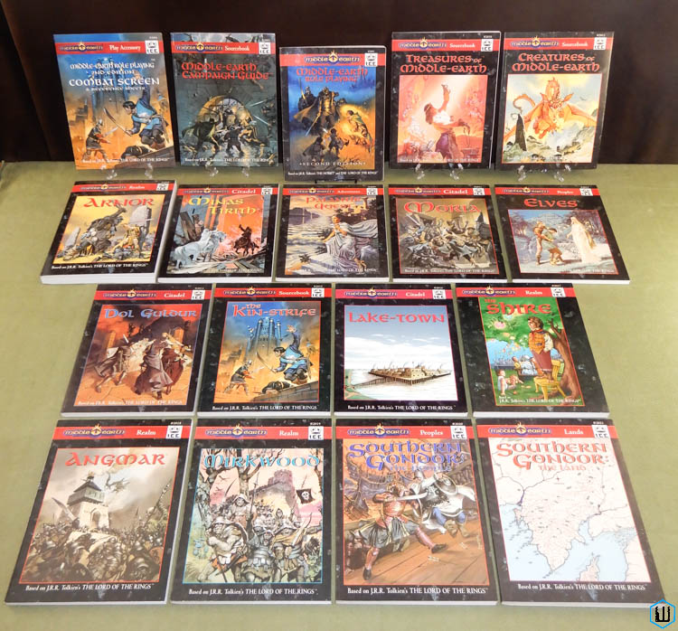 MERP 2nd Edition Campaign Books 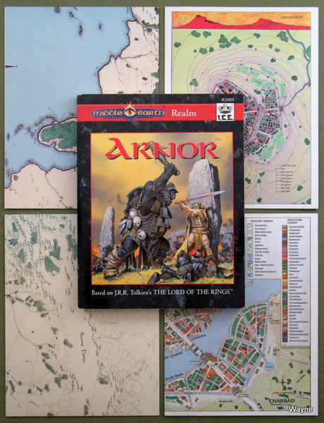 Arnor Arnor
Mapsheets (all 4 panel, 16"x21"): 1) Single side. -Left: Ered Luin in center, Eryn Vorn forest in S. -Right: Minhiriath in NW, "Arnor" note in orange box in SE. 2) Single side. -Left: Forochel in NW, Arthedain in S. -Right: Angmar in NE, Rhudaur in S. 3) Two sides. -Left: Dominated by Lhun river. Ered Luin in NW. Emyn Beraid in S. -Right: Top and bottom panels. Top is Angmar and lands to west. Bottom is Minhiriath. -Left: 3 panels. Town map of Talugdaeri, Glin a-Creag area map, and Cameth Brin/Tanoth Brin profile map. -Right: City map of Tharbad. 4) Two sides. -Left: Oiolad in NW, Rhudaur in NE. -Right: Shire in W, Arthedain in N, Cardolan in S. -Left: 2 panels, top is Fornost Erain, bottom is Annuminas. -Right: 2 panels, top is Frontier Citadel, bottom is Arthadan Star-Tower. "In the year 861 of the Third Age, Arnor was sundered. The death of the tenth and last Arnorian king, Earendur, left the North Kingdom's loyalties split among Earendur's three surviving sons. Amlaith of Fornost, the eldest of the three and thus the Prince most deserving of inheriting his father's full domain, won the Sceptre of Annuminas but in the process lost half of Arnor's territory and much of her power. His brothers staked claim to the eastern and southern lands and successfully countered his attempts to reunify the realm. Thus the North Kingdom split into three independent, neighboring but lesser states: Arthedain, Cardolan, and Rhudaur. This realm module details the three sister kingdoms and their relations with one another. Much of the material covering Arthedain and Cardolan was previously available in Rangers of the North and The Lost Realm of Cardolan. The information on Rhudaur, together with more extensive lore concerning the inhabitants of sundered Arnor, has never appeared in previous modules. Arnor INCLUDES: • COLOR TERRAIN MAPS detailing the lands of Arthedain, Cardolan, and Rhudaur — a total of 10 pages. • MYSTICAL AND RELIGIOUS ORDERS of Arthedain, including the healing Sisters of Nienna and the secret Lmdalistyari. • WARCRAFT used by the three sister kingdoms, including the Dagarim Aran and the Degerim Ereter of Arthedain, the "Raggers" of Cardolan, and the mercenaries who sell their services to the highest bidder—the Ragh Crann-Sleagha, the Cruaidh Maraich, the Troich-Armchleasah, and the Forak-Eiginn. • CASTLES, CITIES AND SITES including the eerie leaning hill of Cameth Brin, bustling and over-populated Tharbad, and the haunted Barrow-downs. • RANGERS OF THE NORTH — their history, organization, duties, and how to create a Ranger player character. • THE FATE OF KINGS, a series of exciting scenarios combining political intrigue with royal warfare. • COLOR CITY MAPS depicting the streets, canals, bridges, and edifices of Tharbad; the avenues, gardens, and libraries of Annuminas; and the earthen dikes, stone walls, and high guard towers of fortified Fornost Erain." 1994 ... 416 pages + 4 color fold-out map sheets ... ICE 2005 ... ISBN 1558061762 Check Wayne's Books Inventory  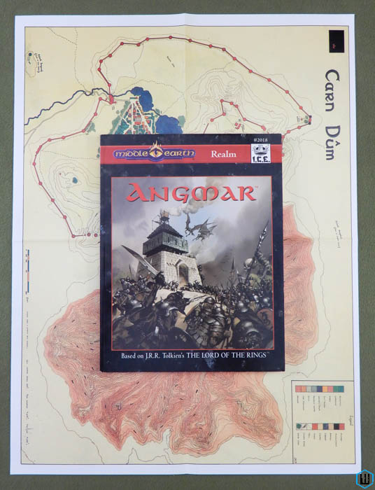 Angmar (2nd edition) Angmar (2nd edition)
Angmar is a reprint of the 1989 ICE campaign module titled Empire of the Witch-king. This reprint as a realm piece features the excellence of the previous bestseller along with a plethora of exquisite new illustrations. Angmar includes complete stats for MERP, the Lord of the Rings Adventure Game, and Rolemaster. Angmar features: COLOR MAPS - depicting the northernmost arm of the Misty Mountains and the highland plateau of the Iron-home, as well as the great fortress Carn Dûm, the seat of the Witch-king's rule. ORC TRIBES - the disunified Orc army that comprises the vast majority of the Witch-king's war host; these troops are controlled by the terrible Olog warlord Rogrog and include the renowned Askai spearmen, the mail-coated Kurkurum, the cannibalistic Ulogarûm, the ritual-driven Uruk-lûgat, and many more. MORNATURI - the six deadly generals who govern the Witch-king's mannish warriors. GULMATHAUR - the three sinister High-priests who formulate strategies to subvert all of Endor to the worship of Darkness. CARN DÛM - the imposing mountain citadel of the Lord of Morgul presented in extensive floorplans accompanied by detailed descriptive text. ORC-HOLDS - maze-like tribal cavern complexes and fetid earthwork "palaces," such as suffocating Storugoruz and noisome Shartap-krûal. RUINS FROM THE ANCIENT DAYS - a sage's mound, a haunted mountain tarn, and a crumbling Dúnadan villa, all of which harbor hidden secrets from the distant past. ORKISH GLOSSARY - over 1000 Orkish words paired with their English translations. WARRIOR PRIESTS & ORC-FIGHTERS - rules for creating player-characters who operate under the Witch-king's iron rule. 1995 ... 160 pages + double-sided color fold-out map ... ICE 2018 ... ISBN 1558062440 Check Wayne's Books Inventory  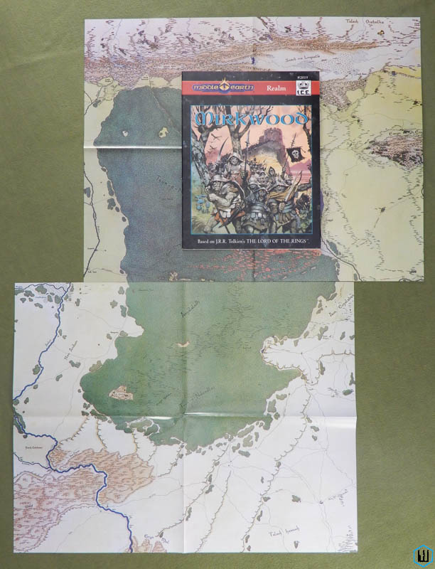 Mirkwood (2nd edition) Mirkwood (2nd edition)
"Mirkwood is a reprint of the 1988 ICE campaign module titled Mirkwood, The Wilds of Rhovanion. This reprint as a realm piece features the excellence of the previous bestseller along with a number of new floorplans and illustrations. Mirkwood includes complete stats for MERP, the Lord of the Rings Adventure Game, and Rolemaster. Mirkwood features: COLOR MAPS - two beautifully rendered maps depicting northern and southern Mirkwood, as well as the varied lands adjacent to the vast forest. RADAGAST & RHOSGOBEL - the master of shapes and hues and his wizardly home with its many woodland visitors. NORTHMEN - Beornings whose lords practice shape-shifting; Sairthéod in their tree-house village; Dalemen and Lakemen, descendants of the noble First-Age Edain; Woodmen who rove the forest in clans; and horse-loving Éothraim, ancestors of the Rohirrim. DWARVES OF THE IRON HILLS - the stalwart forefathers of Dáin Ironfoot who came to Thorin Oakenshield's aid at Erebor later in the Age. THE ELVES OF THRANDUIL'S HALLS - wood-wise folk who celebrate starlight, song, and the trees of the forest with feasting and harp music in scenic glens. CREATURES OF SHADOW - Dragons from the Withered Heath who fly south in search of prey; Great Spiders and their dark webs that reach from trunk to trunk; Stone Trolls who roam the Emyn-nu-Fuin; and wakeful trees with evil hearts and hostile boughs. MINIONS OF THE NECROMANCER - the Ringwraith who rules the Naked Hill; the Black Trolls who serve as the citadel's warlords; and the hordes of Orc-warriors who raid at their command. CULT OF THE LONG NIGHT - animistic shamans who revere darkness and teach its tenets on moonless nights. DARK SITES - Sarn Goriwing, the sorcerous tower dominating the headwaters of the Enchanted River; the Nan Morsereg, a vale harboring dark cults and nocturnal terrors; and the Gloom-spike, lofty home to a crazed seer. 1995 ... John David Ruemmler & Susan Tyler Hitchcock & Peter C. Fenlon ... 160 pages + 2 single-sided color fold-out maps ... ICE 2019 ... ISBN 1558062467 Check Wayne's Books Inventory   The Northern Waste The Northern Waste
The Northern Waste unlocks an exciting new realm of adventure never before covered by ICE's Middle-earth series. Now at last you can travel to the northernmost shores of Middle-earth - and beyond! The Northern Waste includes complete stats for Middle-earth Role Playing, Rolemaster, and Lord of the Rings Adventure Game. It is the first MERP module to contain scenario material for ICE's best-selling Middle-earth Collectible Card Game. The Northern Waste features: COLOR MAP - An exquisitely drawn map (17" x 22") brings the Northern Waste to life with vibrant color and elegant realism, covering nearly 450,000 square miles of breathtaking terrain. LOSSOTH - Sojourn with a people whose strange customs and lifeways are profoundly shaped by the harsh environment in which they live. Learn the riimut, the enchanted runes through which the Lossoth channel the invisible energies of the Spirit World. Witness one of the bloodless "song duels" the Snowmen use to settle disputes. Meditate upon the wisdom of tasapaino, the ideal of harmony and balance that guides the hearts and deeds of this practical yet noble culture. THE LANDLESS LAND - Dare to tread the pathless leagues of Arda's polar ice-cap. Behold Helloth, fabled ice-city of the Snow-elves that guards Helecthil, the mysterious source of the northern lights. MORGOTH'S REALM - Explore the cyclopean wreckage of Angband, birthplace of dragons and ancient stronghold of Morgoth. Evade the elemental spirits that prey upon the Free Peoples of the land: Jäänainen, Siren of the Ice; Eloeklo, Demon of the North Wind; Durlach, Balrog of the Fire Veils. EVERMIST - Seek the hidden valley of Evermist, sanctuary to a secretive order of Noldorin mystics sworn to rid the Northern Waste of Morgoth's taint. Undertake a vision path to recover one of the lost yavanníri, the frozen tears shed by Yavanna for the healing of the Wounded Land. ADVENTURES - Two full-length, ready-to-run scenarios offer instant adventure. Rumors of "The Ivory Hoard" lure fortune-seekers onto the fringes of the Northern Waste, presenting the GM with a golden opportunity to acquaint players with the Lossoth and their customs. Meanwhile, terror strikes Forochel's bay as stout-hearted heroes gird themselves for a deadly foray into "The Haunted Berg." MECCG SITES AND SCENARIOS - Expand your Middle-earth card game into the Northern Waste with three exciting new scenarios and a host of new sites all laid out on the reverse side of the color terrain maps. 1997 ... Randy Maxwell ... 189 pages + map ... ICE 2025 ... ISBN 1558062963 Check Wayne's Books Inventory  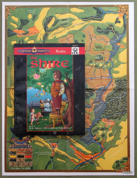 The Shire The Shire
"The Shire features: COLOR MAPS - vivid renditions of the Shire in T.A. 1640 and T.A. 3018. THE GLENNEN - the mountain slopes and river vales where the Hobbits first lifted their faces to the sun, paddled their cockle-boats, and shrank from the Shadow that gathered in the East. SIRAGALË - the rolling hills, that would one day become the Shire, but first were roamed by the Sirannar, a reclusive branch of the Nando Elves. THE SHIRE GRANT - an account of the unique political tangle that culminated in the gift of the Shire to the Hobbits from Arthadan King Argeleb II. THE SHIRE OF BILBO'S DAY - that pocket of tranquility guarded secretly by the Rangers of the North. THE TOOK-THAINS - the chieftains of that adventuresome family of Hobbits from whose lineage sprang Bilbo and Frodo. HOBBITS - the renowned heroes Merry, Pippin, and Sam, as well as more anonymous personalities with an equal measure of bravery, Kocho Kurl, Molly Boffin, Gresham Shaper, and others. SITES - smials and hamlets of the Hobbits, tree-garths of the dwindling Sirannar, and manors of the Dúnedain. ADVENTURES - join the Periwott Halflings in their struggle with unexpected guests: an Orc ambush camped on their doorstep; discover the malevolent aims of the "Nackers," bogies with sharp fangs and claws who haunt the nights in the Marish; learn the origins of the great wolf that witnesses riots and stonings, proof that the passions of the Elder Days still breath their peril into the tame lands of even the Shire." 1995 ... Wesley Frank ... 276 pages + double-sided fold-out map ... ICE 2017 ... ISBN 1558062343 Check Wayne's Books Inventory  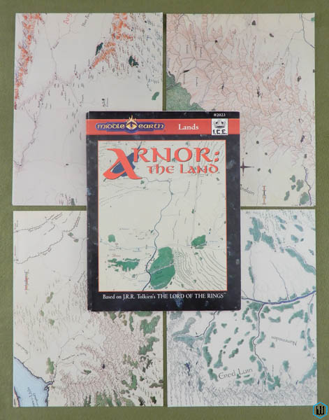 Arnor: The Land Arnor: The Land
Arnor: The Land represents a thorough updating of the second-half of ICE's highly acclaimed Arnor realm module (previously published in 1994), and includes complete game statistics for MERP, Rolemaster and the Lord of the Rings Adventure Game. Arnor: The Land features: COLOR MAPS - Four detachable, intersecting maps (17" x 22" each) combine to form a single, stunning panorama of Eriador, covering nearly 30,000 square miles of terrain. On the reverse side of these maps, intricately detailed color layouts of major cities and fortresses are provided. BANES OF ANGMAR - Delve into the inner workings of the Witch-king's malice as he contrives dark plagues, killing curses, and unnatural blights against the Dúnedain, by whose valor alone the annihilation of the Free Peoples in the North is hindered. THARBAD - Visit the great riverine metropolis of Tharbad, where the Men of Númenor first began to colonize the lands of the North. Once the capital of Cardolan, Tharbad has become the object of contention for all who would seek hegemony in southern Eriador. BREE - Partake of the rustic hospitality and parochial charm of the Bree-landers, whether at the common room of the King's Rest Inn, or amid the pastoral serenity of the surrounding farmlands that soften the sometimes grim landscape of war-torn Eriador. BARROW-DOWNS - Dare to tread among the grassy mounds that house the remains of Arnor's past kings and their Eriadorian forefathers, now infested by the evil spirits know as the "barrow-wights". BANNERS OF THE HIGH KING - Join the Elven-king Gil-galad's banner-bearers on their perilous trek across the breadth of Eriador, carrying pledge of their lord's support for the Last Alliance of Men and Elves against Sauron. Frustrate the Dark Lord's unrelenting efforts to thwart this all-important mission, but beware of treachery from within your own ranks! 1997 ... 231 pages ... ICE 2023 ... ISBN 1558062882 Check Wayne's Books Inventory  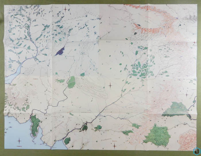 I was asked how well the 4 Arnor poster maps assemble, so here we go! They do match up nicely, forming a giant 33 x 43 inch campaign setting, "covering nearly 30,000 square miles of terrain." For GMs setting their Middle Earth RPG campaign in Eriador, these maps are perfect. Regions include The Shire, Numeriador, Arthedain, Cardolan, Angmar, Rhudar, and Eregion. There are slight color shifts between the maps, but geographical features line up well. Click for a larger image! -Wayne  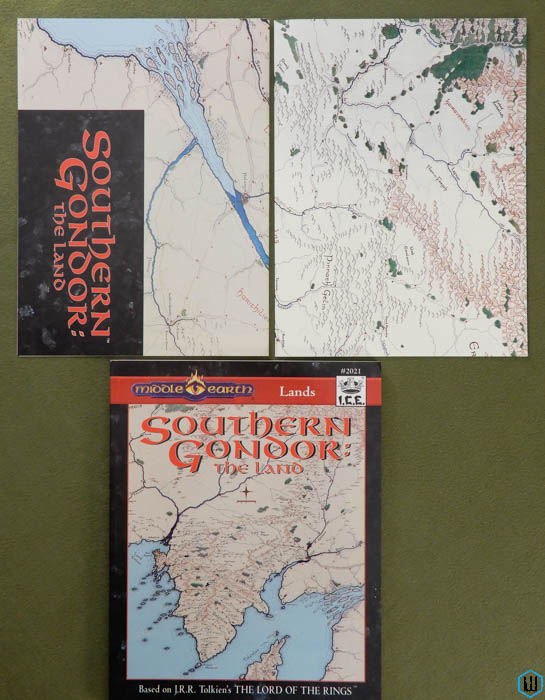 Southern Gondor: The Land Southern Gondor: The Land
Maps: 1) Double-sided. Front has a large label "Southern Gondor: The Land," and is a color regional of the area. Reverse is a color city map of Pelargír. 2) Double-sided. Front is a large regional map of the littoral portion of Gondor. Reverse is a color city map of Lond Ernil, and a large map key to the city. -Wayne "Southern Gondor: The Land presents Gondor's coastal provinces in vivid color and detail. The route of humble country lane and famous high road; the scattering of manor, hamlet, village, and town across hill and dale; the placement of beacon, guard posts, haven, and citadel; the ebb and flow of peril and adventure — all play a part in this exciting region. Travel the highways and byways of southern Gondor like the intrepid King's Writer who tested the accuracy of his monarch's maps. Discover genial hosts, unusual folk ways, geological wonders, and secrets that linger from the days of the Second Age and the Numenorean colonies sheltered by the middle continent. And beware the sea-longing that stirs the hearts of all who linger too long by Belegaer's waves and breezes. Southern Gondor: The Land includes complete stats for MERP and Rolemaster Southern Gondor: The Land features: COLOR MAPS - 2 exquisite terrain maps depicting Gondor's coastal provinces and territories from Andrast and Anfalas through Lamedon and Belfalas to Harithilien at the skirts of the Ephel Dúath. GAZETTEER - a convenient compilation of the significant and fascinating sites and features of southern Gondor, including these six and many more: - Bar Morthil, royal estate at Andrast's tip. - Cûm Taran, sacred highlands of five faithful Daen clans in the Ered Torthonion. - Gobel Tolfalas, seat of the fief's royal warden. - Iant Harnen, engineering marvel that spans a vast river valley. - Men Dirnen, a caravan route dating from the Second Age. - Úlond, the treacherous waters off the Andrast coast. FINDEGIL'S COMMENTARY - scholarly notes on Sindarin place-names penned by the engaging traveler and King's Writer who knew the pleasures of warm hospitality and a well-stoked wine-cellar and who enjoyed a quixotic passion for linguistic purity. HAVENS - Pelargir and its magnificent ship-garth; Lord Ernil, the heart of Gondorian reverence for the Lady of the Seas; and Edhellond, way station for Elven pilgrims to the West. CITADELS - Tir Groth, an ancient Elven-fortified grotto blessed by Ulmo's favor; Lugh Gobha, the Coentis cavern-stronghold tainted by the Oathbreaking and haunted by shades of the dead; Tirith Aaer, the magnificent Sea-ward Tower where Galadriel dwelt for a time; Hall of the Faithful, Pelargir's sacred repository for Ulmo's blessing and the knowledge tradition of Númenor and Ost-en-Ernil, the massive fortress of the Prince of Belfalas. THE LOST ELENDILMIR - trace the strange journeys of a priceless artifact of ancient Númenor and recover it for the rightful king of Gondor. RISE OF THE PRETENDER - navigate the tumultuous currents of Haruze ambition and resentment when an unscrupulous claimant seeks the Gondorian throne." 1996 ... Jason Beresford & Anders Blixt & Jessica Ney-Grimm ... 205 pages ... ICE 2021 ... ISBN 1558062564 Check Wayne's Books Inventory  All MERP products Copyright © TOLKIEN ENTERPRISES, a division of ELAN MERCHANDISING INC., Berkely CA. Middle-earth PBM, The Hobbit, The Lord of the Rings, and The Return of the King, all characters and places therein are trademark properties of TOLKIEN ENTERPRISES. All characters and places derived from the works of J.R.R.Tolkien are common law trademarks used under license from Grafton Books (Harper Collins), publishing successors to Unwin Hyman, Ltd. and George Allen & Unwin, Ltd., London, UK.| MERP Campaign Settings | MERP Cities - Fortresses - Citadels | MERP Sourcebooks | MERP Adventures | MERP Gamebooks | | 2300 AD | 7th Sea | AD&D | Aftermath! | Albedo | Aliens | Arduin | Alternity | Amazing Engine | Amber Diceless | Ars Magica | Atlantis | Babylon 5 | Battletech | Boardgames / Wargames - Other | Boot Hill | Buck Rogers | Bushido | Call of Cthulhu | Castle Falkenstein | Chill | Chivalry & Sorcery | Conan | Cyberpunk | Cyborg Commando | Dark Conspiracy | DC Heroes | Deadlands | Doctor Who | DragonQuest | Dream Park | Dune | Dungeons & Dragons | Dying Earth | Earthdawn | Elfquest | Elric / Stormbringer | Everway | The Fantasy Trip | Foreign Language Roleplaying Games | Game of Thrones | Gamma World | GangBusters | Gear Krieg | Ghostbusters | GURPS | Harn | High Fantasy | Indiana Jones | James Bond | Jorune | Judge Dredd | Justifiers | Living Steel | Lords of Creation | Man, Myth & Magic | Marvel Super Heroes | Middle Earth Role Playing | Midkemia | Military Roleplaying Stockpile | Millennium's End | Miscellanea | Morrow Project | Mythus - Dangerous Journeys | Nightlife | Pendragon | Phoenix Command | Powers & Perils | Red Sonja | Renegade Legion | Riddle of Steel | Ringworld | Robotech | Rolemaster | Runequest | Shadowrun | Sovereign Stone | Space 1889 | Space Master | Space Opera - Other Suns | Star Ace | Star Frontiers | Star Trek | Star Wars | Super Hero RPGs | Talislanta | Talisman | Tekumel | Terminator 2 | Thieves' World | Timemaster | Top Secret | Traveller | Tribe 8 | Tunnels & Trolls | Twilight: 2000 | Villains & Vigilantes | Warhammer | Whispering Vault | Willow | Witchcraft | Ysgarth | CAMPAIGN BUILDING | RPG MAGAZINES | Avalanche Press | Avalon Hill | Bard | Chaosium | Columbia Games | Dream Pod 9 | Fantasy Games Unlimited (FGU) | FASA | Flying Buffalo | Game Designers Workshop (GDW) | Gamelords | Gamescience | Games Workshop | Judges Guild | Leading Edge Games | Mayfair Games | Metagaming | Pacesetter | Palladium | SPI | Steve Jackson Games | Tri Tac | TSR | Victory Games | West End Games | White Wolf | Wizards of the Coast | Yaquinto Publications | | Return Home | What's New | Contact WaynesBooks.com | |
||
 |
 |
